Tocht Stappen La Chapelle-aux-Saints - Sur les traces de Néandertal - La Chapelle aux Saints - Pays de la vallée de la Dordogne Corrézienne - Photo

Sur les traces de Néandertal - La Chapelle aux Saints - Pays de la vallée de la Dordogne Corrézienne

 tracegps
tracegps

Gebruiker

© OpenStreetMap contributors
Lengte
Lengte
9 km
Max. hoogte
Max. hoogte
179 m
Positief hoogteverschil
157 m
Km-Effort
Km-Effort  
11,1 km
Min. hoogte
Min. hoogte
126 m
Negatief hoogteverschil
157 m
Boucle
Boucle
Ja
Datum van aanmaak :
2014-12-10 00:00:00.0
Laatste wijziging :
2014-12-10 00:00:00.0

(1 Bericht)

Stappen
Stappen
2h30
Moeilijkheid : Medium

Scan deze QR-code om de tocht te openen in de SityTrail-applicatie

Gratisgps-wandelapplicatie

Logo SityTrail SityTrail

IGN / Geografische instituten

SityTrail uit de App Store downloaden SityTrail uit Google Play downloaden

Logo SityTrail SityTrail World

De wereld gaat voor u open

SityTrail uit de App Store downloaden SityTrail uit Google Play downloaden SityTrail op Huawei AppGallery downloaden

Over ons

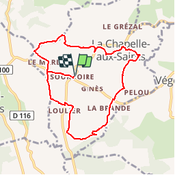
Tocht Stappen van 9 km beschikbaar op Nieuw-Aquitanië, Corrèze, La Chapelle-aux-Saints. Deze tocht wordt voorgesteld door tracegps.

Beschrijving

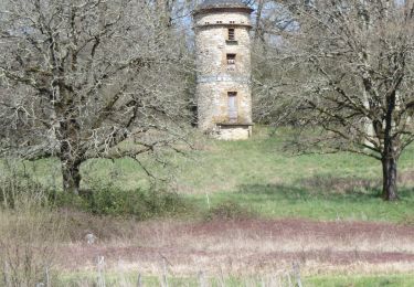
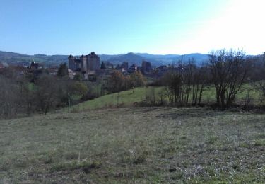
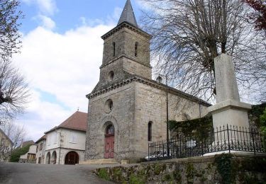
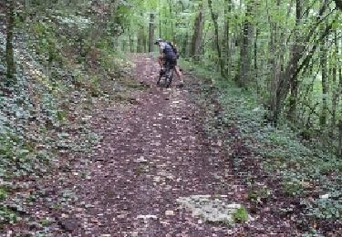
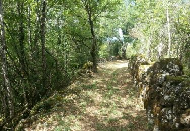
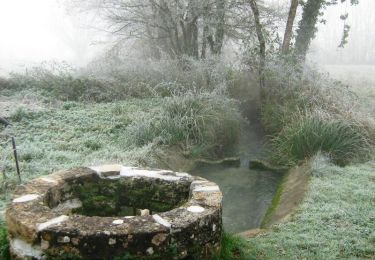
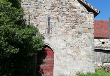
Partant du Musée dans la vallée du Maumont et de la Sourdoire, terres de chasse de l'Homme de Neandertal, le circuit fera découvrir, au gré des chemins, les curiosités de La Chapelle-aux-Saints : fontaine de Sarrazac, Moulin de Pouget, presbytère du Laurent, église du 12ème siècle, lavoir, oratoire Saint-Thomas, Bouffia Bonneval et vues sur le Limousin et le Quercy. Téléchargez la fiche du circuit sur le site du Tourisme en Limousin.

Hoogteprofiel

Foto's

Plaatsbepaling

Land:
France
Regio :
Nieuw-Aquitanië
Departement/Provincie :
Corrèze
Gemeente :
La Chapelle-aux-Saints
Locatie:
Unknown
Vertrek:(Dec)
Vertrek:(UTM)
398582 ; 4981767 (31T) N.

Opmerkingen

Gelieve in te loggen om een commentaar of een beoordeling achter te laten


Wandeltochten in de omgeving

Tocht Stappen Bilhac - BILLAC - Photo
Stappen
houbart

Stappen

Moeilijk
(1)
Bilhac, Nieuw-Aquitanië, Corrèze, France
10,3 km | 13,3 km-effort
3h 0min
Ja
Tocht Mountainbike Curemonte - Circuit des sentes - Photo
Mountainbike
sdroneau

Mountainbike

Moeilijk
(1)
Curemonte, Nieuw-Aquitanië, Corrèze, France
26 km | 37 km-effort
3h 4min
Ja
Tocht Stappen Queyssac-les-Vignes - Entre vignes et noyers - Queyssac les Vignes - Photo
Stappen
tracegps

Stappen

Medium
(1)
Queyssac-les-Vignes, Nieuw-Aquitanië, Corrèze, France
8 km | 10,7 km-effort
2h 0min
Ja
Tocht Mountainbike Chauffour-sur-Vell - Le bois de l'empire - Photo
Mountainbike
sdroneau

Mountainbike

Moeilijk
(1)
Chauffour-sur-Vell, Nieuw-Aquitanië, Corrèze, France
26 km | 34 km-effort
3h 0min
Ja
Tocht Stappen Queyssac-les-Vignes - Le vin paillé - Photo
Stappen
sdroneau

Stappen

Gemakkelijk
(1)
Queyssac-les-Vignes, Nieuw-Aquitanië, Corrèze, France
10,4 km | 13,8 km-effort
2h 30min
Ja
Tocht Mountainbike Chauffour-sur-Vell - Aux confins du Quercy - Chauffour sur Vell - Pays de la vallée de la Dordogne Corrézienne  - Photo
Mountainbike
tracegps

Mountainbike

Medium
(1)
Chauffour-sur-Vell, Nieuw-Aquitanië, Corrèze, France
15,5 km | 18,7 km-effort
1h 19min
Ja
Tocht Mountainbike Chauffour-sur-Vell - 2019-12-28_17h26m41_L'Hôpital(32km) - Photo
Mountainbike
Gpoujade

Mountainbike

Moeilijk
(1)
Chauffour-sur-Vell, Nieuw-Aquitanië, Corrèze, France
32 km | 41 km-effort
2h 48min
Ja
Tocht Mountainbike Chauffour-sur-Vell - curemonte/Collonges:la boucle verte - Photo
Mountainbike
fesseneric

Mountainbike

Medium
(1)
Chauffour-sur-Vell, Nieuw-Aquitanië, Corrèze, France
31 km | 39 km-effort
2h 31min
Ja
Tocht Stappen Queyssac-les-Vignes - Fred BC Queyssac-les-Vignes  - Photo
Stappen
arnoultjf

Stappen

Medium
Queyssac-les-Vignes, Nieuw-Aquitanië, Corrèze, France
8,6 km | 11,6 km-effort
2h 48min
Ja


Sluiten
Mijn abonnementen